Where we think we will go and where we end up are sometimes not the same. What we had intended was to drive up a dirt road to the mouth of Black Dragon Canyon, then to hike up the canyon to see pictographs and maybe even to find the dragon's lair: a cave near a dragon pictograph.
To get to the mouth of the canyon, you have to carefully turn off of westbound Interstate 70 onto a dirt road. Alas, road construction and orange cones made us miss the turnout and the next exit is miles away. There is a viewpoint above the canyon however. We stopped to look down on where we thought we would be hiking.

The San Rafael Reef


Is that the lair?

Maybe we didn't really want to hike down there.
We found this map at the Flying J in Winslow. We found that our other maps were inaccurate for roads in the Navajo Nation. This map was invaluable to us: it is great for the entire Four Corners area as far north as Green River.

On the map we saw a landmark called Dutchman's Arch right off of I-70. "Let's go there", I said. Right off Interstate 70. As in several miles of dirt roads which then come back to Interstate 70.

And then you get to go under the Interstate through a drainage tunnel.


Then you guess which fork of the road to take to go to the arch and you guess wrong. But you see a cliff ahead and cliffs tend to be interesting.

And cliffs with fences around them tend to be even more interesting.


We wandered around and climbed up rocks and looked and looked. Now we realize that what we were searching for were in the first pictures Tom took.


The rocks themselves are spectacular.

I am much more sure-footed now that I have hiking boots that fit properly.


Found this large clump of hedgehog cactus.


And then I saw them.

They were under the overhang just as I thought they should be.


I'm not too worried about these pictographs being destroyed in the short term. It takes a high-clearance vehicle to reach them which will keep casual tourists away. There are no signs anywhere that lead you to the area.
Back down the road.

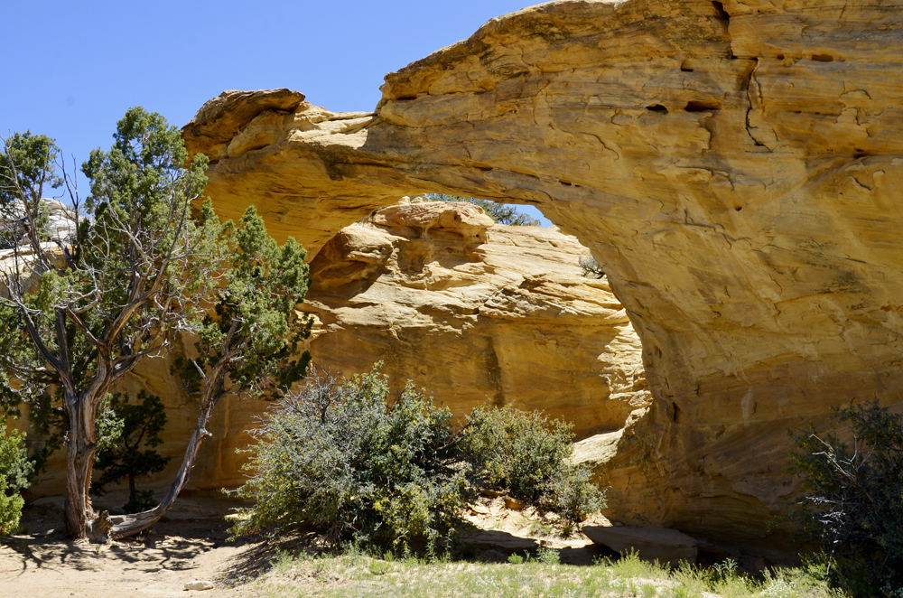
We took the other fork and the arch was right around the corner.


A pair of red-tail hawks played in the air currents above us.


Retracing our trail to the more major dirt road (passable with a passenger car) we went to seek out Temple Mountain. It lies in the San Rafael swell, just Northwest of Goblin Valley.

Temple mountain seen in the background.

Factory Butte.


Pretty Buckwheet


I believe this is a balsamroot but if someone tells me different I will change it.

A BLM dispersed camp spot with a view of Temple Mountain.


Looking down to the San Rafael desert and the Green River canyon beyond.


Until next time: Southern Utah, you rock!