Tombstone

It's a tourist town. You can buy tickets to a reenactment of the gunfight at the O.K. Corral. We skipped that. You can take a stage coach ride around town. Skipped that one too. You can shop at lots of tourist-trappy stores. We mostly skipped that.

We did visit the old courthouse, now a museum.

The courtroom with mostly original furnishings.

The old pictures and documents are well worth a visit.

Many of the residents of Boot Hill came here first.

I didn't buy this shirt, but have sure wanted it at times in some of the parks we have visited.
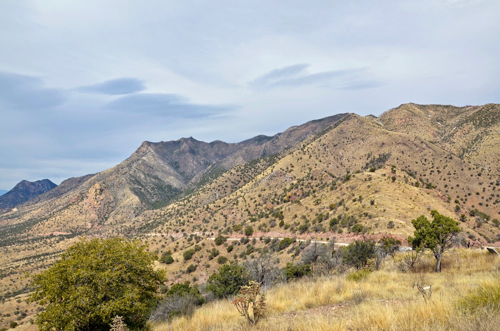
The San Pedro Riparian NCA

Ancient giant cottonwood. We would have liked more time in the area to photograph birds, but it was not to be this trip.
The Arizona Wine Trail

Knowing that Dick Erath had retired to SE Arizona and was working with local winemakers, we had planned for some time to hit a few of the local wineries. Overall we were pleased with the quality of the wines.

Map above is from arizonawine.org
We visited Dos Cabezas in Sonoita and came away with quite a few bottles as well as a T-shirt:

Usually a true statement. Overall that was my favorite stop.
We also visited Rancho Rossa: thumbs up to them as well. Callaghan went too much into buying California grapes and copying California wines. We were looking more for something grown and vinted in the region, not just yet another Cab. Then there was Sonoita Vineyards who might have gone too far the other way: it's great make wine from only your own grapes but some years you might need help.
At Rancho Rossa we were advised that based on our preferences we could probably skip the Village of Elgin Winery. Something about being a fun place for White Zinfandel lovers (my apologies to those of you who might be reading).
Being wined out, we will leave other wineries for a future visit. We decided to drive south on Highway 83, having seen a road leading back to Sierra Vista on Google maps.

It was an interesting drive, and not what I expected. Not that I knew what to expect. Elgin is at 4767' in elevation and the road ends at Parker Canyon Lake, 5400'. The landscape is oak savannah and semi-forested mountains.

Beautiful country, and quite remote.

So remote that there was no Verizon coverage when we got to the lake. No Verizon coverage = no Google maps = no navigation. Should I admit that this was on Friday the 13th?

We can get a map now of what we meant to do, but at the time we saw a maze of dirt roads going who knew where. The only sign we saw directed us to Nogales and we knew that we didn't want to go there. So we ended up retracing our steps back up 83 and then east on 82.
The next day was Valentine's Day. We started the day by finding brunch in Sierra Vista at Papa's 50's Diner. It seemed like a good idea at the time. The food was ok. The decor was cute. The music was all from the 60's (maybe young people who didn't know better chose it?). The service was abysmal. It may have been one of the only times ever that we left No. Tip. Just in case you ever find yourself in need of food in Sierra Vista: it is the home to a large military base and is a bastion of Corporate America and box stores.
Coronado National Memorial
Heading on after brunch, we happened on a sign for the Coronado National Memorial We try to visit every national park and monument we find. And a find this was.

You climb up a steep and twisty dirt road to get to the top, but it is passable for regular passenger vehicles. Once you get up there, the views are amazing.


A detail of brightly colored cholla.

The mountain range you see in the background is the Sierra Madre in Mexico. The actual border lies in the plain between the mountains, which makes things interesting.


Our ever-vigilant Homeland Security. Actually I believe the agent was reading a book in his SUV, figuring that the radar would alert him of any activity on the plain below.

Everywhere we went from Sierra Vista to the border we could see the blimp looking for people doing things they shouldn't, like trying to cross the border. It is deployed daily from the base in Sierra Vista.

We also found a sign directing us to a route to take to Parker Canyon Lake. Next time we'll know. It is a 4-wheel drive road: Google says to allow an hour for the 20-mile trip.
Bisbee
The person at Rancho Rossa was responsible for our visit to Bisbee. She said that it isn't "touristy like Tombstone." True: it is artsy-touristy rather than western-touristy.

As you approach the town you can tell that things are different. Look at the colors in the cliff!

The town is built on a hill with extremely steep streets above this:

The Copper Queen Mine. No time for a tour, but even just the pictures from the top were spectacular.


Better than Bisbee is the next-door town of Lowell.

Some of us are old enough to remember when main streets looked like this. Maybe some of the cars were in a little better shape.


An American Brigadoon?


It was fun to see and to remember.
Leaving Bisbee and Lowell, our final place to see were the border towns of Douglas (US side) and Aqua Prieta (Mexico). Not much to say about the not-so prosperous towns except for all of the security and the border fence.

Or rather border fences. Plural. The semi-attractive original white fence has been augmented with the fortress-like black.
I know we are each entitled to our opinion about immigration, but there are some things that make me not so proud.
I know we are each entitled to our opinion about immigration, but there are some things that make me not so proud.